Seattle Maps 16 & 17 – Puget Sound

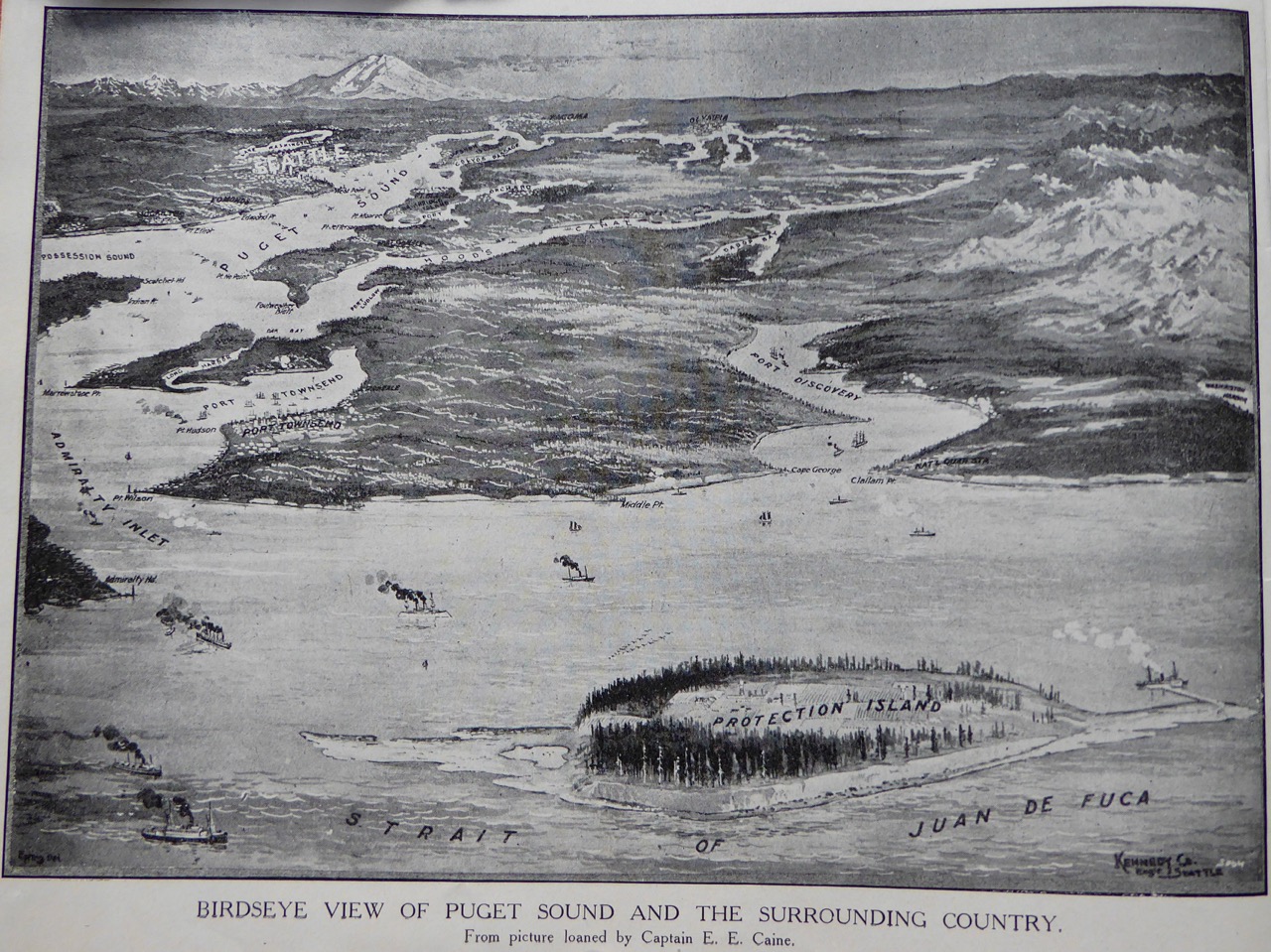
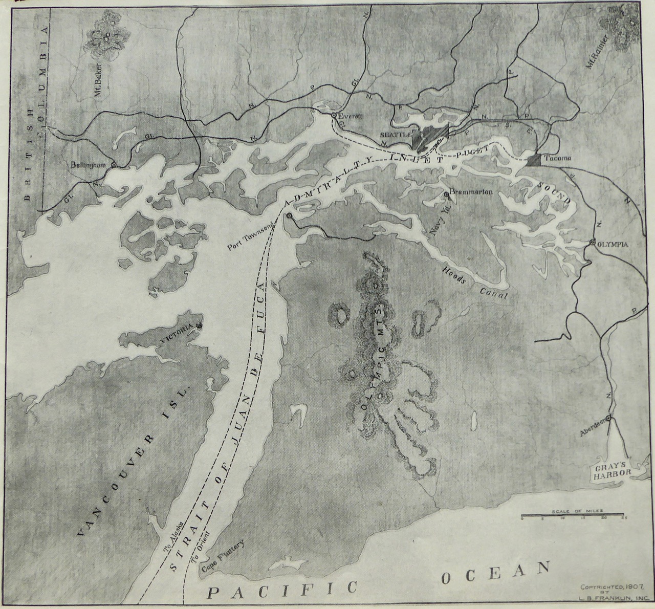
Two fine images of Puget Sound that I came across the other day. Protection Island now has very few trees on it and is a good place to see puffins. Note on the lower map how far south Admiralty Inlet extends. These boundaries of Admiralty Inlet and Puget Sound were the original ones as defined by Capt. George Vancouver, who named it in May 1792. (click on images for larger size)

Puget Sound from the North
Puget Sound turned sideways with north to the left

Quote 5 – That old Giant!

“If there is one thing above another in our famous Sound region that transcends all else in the way of adoration and homage it is Mount Rainier. That old Giant! How overpowered one is by its bigness and nearness, as the mists of morning clear away and its glistening, snowy form rises majestically before you–standing there so Sphynx-like in its immovability, so grand, so bold, so defiant, towering above the lesser hills around it!”
Beth Bell Higgins, Souvenir and Guide Book of Seattle–Twenty Third International Christian Endeavor Convention, July 1907