Canal in the news

My new book, co-written with Jennifer Ott, will be in stores in a couple of weeks. As a little sneak peak, the Seattle Times has published an excerpt.

Seattle magazine also included a feature about the locks and ship canal based on Waterway: The Story of Seattle’s Locks and Ship Canal.

And Jen and I will be reading from the book on July 12 at MOHAI and July 23 at the Seattle Public Library, Central Branch.
Unique Map of Tideland and Ship Canal

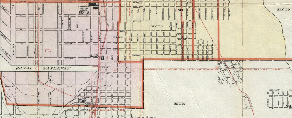
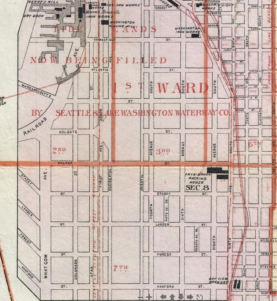
My pal Rob Ketcherside recently passed along a link to an amazing map of Seattle. It’s the 1896 Anderson’s Street and Guide Map of the City of Seattle. (At present, as you can see, the map is for sale.) I have seen an earlier Anderson map and found it very useful for its details on city streets. What makes this one unique is that it’s the best map I know of that shows the planned South Canal across Beacon Hill in detail. This was the canal proposed by Eugene Semple. It was not built.

Detail of 1896 map showing canal cutting across Beacon Hill

In addition, the map also includes a fine detail of the filling in of the tideflats, also a project of Eugene Semple.

Detail of 1896 map showing tideflats filling.