John de Fuca’s Strait – Puget Sound Map 1797

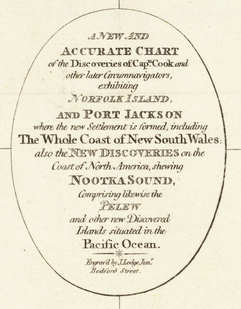
Now we know what the Strait of Juan de Fuca could have been called. Or at least it could have been so, according to cartographer John Lodge, who engraved this map in 1797. Created to show the discoveries of Captain James Cook throughout the Pacific Ocean, the map also contains a few intriguing features in the Pacific Northwest.

The most obvious is one of the more original names for the long waterway that separates the future British Columbia from the future Washington State. I also like the spelling of Mt. Olimpius and Shoal Water, for what became Shoalwater and later Gray’s Harbor. And, despite the map coming out five years after George Vancouver named Puget’s Sound, it does not appear on the map. But then again, Mr. Lodge was highlighting Captain Cook’s discoveries. Curiously though Cook did not think that there was what he called the “pretended Strait of Juan de Fuca.”

Origin of this image of the map. Barry Lawrence Ruderman Antique Maps, Inc.

John Lodge's Map of Captain Cook's "Discoveries" 1797
John Lodge’s Map of Captain Cook’s “Discoveries” 1797
Title of Map
Title of Map


Seattle’s Safe from Earthquakes

I bet you didn’t know that Seattle is safe from earthquakes. According to a University of North Carolina geologist Collier Cobb it is. He had this to say to a meeting of the Chamber of Commerce: “Other sections may suffer earthquakes, but Seattle, set in the deepest glacial drift yet discovered on this continent, has a shock absorber which makes the city immune from disaster from quakes.” Sadly he was wrong but then again, Dr. Cobb made his comment in October 1920.

Cobb arrived in Seattle after spending six weeks exploring the shorelines of Alaska and Puget Sound. In a his speech to the Chamber, he noted that Seattle’s “wonderful harbor, unmatched anywhere on this continent” had been carved out less than 2,000 years ago by glacial action. During this process, the ice generated 900 feet of glacial drift, which he defined as “the scrapings of the best top soil of other sections.” This glacial action was the “most recent on the face of the globe.” Because of the great depth of the drift, its shock absorbing quality meant that “there are no sharp faults, which can make for a serious seismic disturbance here…Seattle is secure for all time.”

We now know that Cobb was wrong on all accounts. The glacial ice and water flowing under it did carve out the region but that was roughly 16,500 years ago. We also know that three major faults zones affect Seattle. 1. The deep Benioff zone quakes, which moved in 1949, 1965, and 2001. 2. Cascadia Subduction, which last moved in January 1700, had a magnitude of more than 9.0, and generated a tsunami that hit Japan. 3. The Seattle Fault Zone, which last moved about 1,100 years ago and produced more than 20 feet of uplift. Oh well. It was a nice thought.

Seattle Times June 30, 1925