The other day I spent eight hours at Discovery Park watching the tide go out and return. It was the best experience I have had of the dramatic change that occurs in Puget Sound on a daily basis as the level of the water changes as much as 15 feet in a day. Doing this also prompted me to take a look at three maps I have that show the Magnolia peninsula.
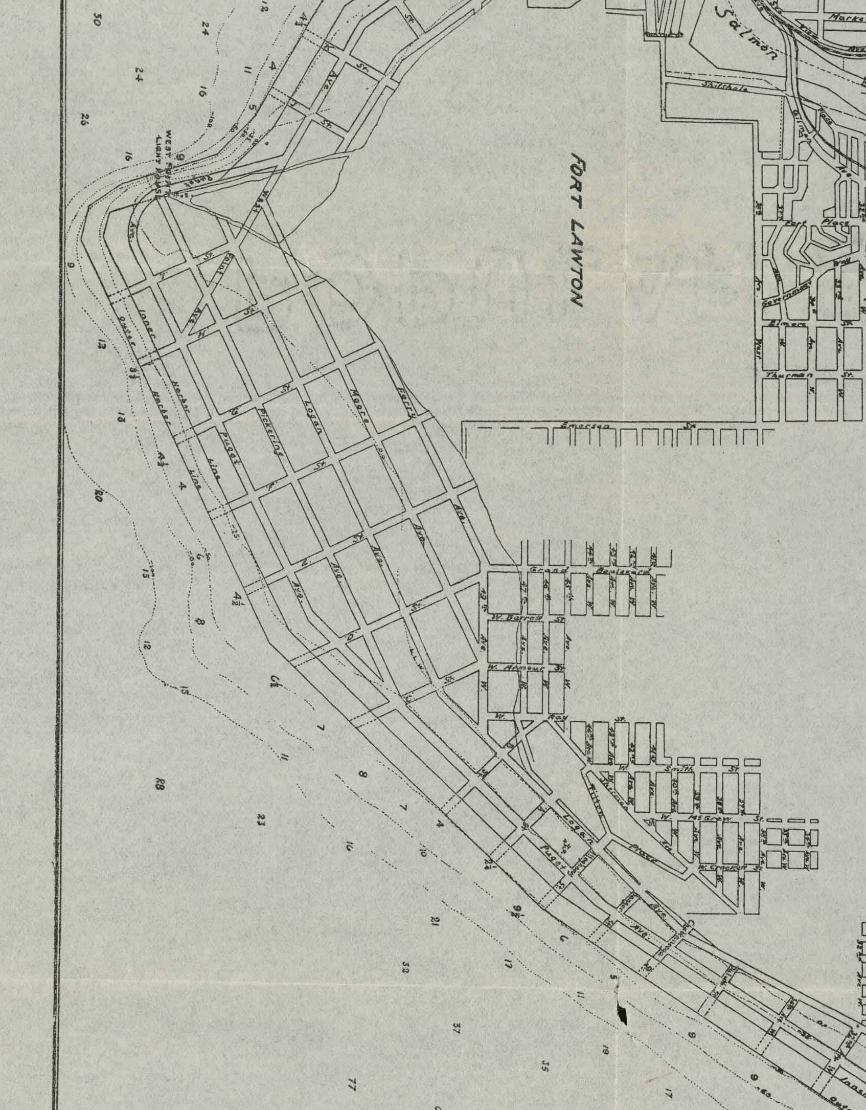
What stands out is that each of the maps shows the low tide terrace platted with streets. It is yet another case of “what the hell were the planners thinking?” I guess they imagined building some sort of wall that would keep the tide out.
It’s also interesting to note the original platted street names changed from 1894 to 1913, followed by another small change from 1913 to 1934. I also like how in the 1913 map, West Point Avenue is planned to cut right across West Point.
Board of State Land Commissioners Map of Seattle Harbor, Surveyed Oct, Nov, Dec. 1893 and Jan. 1894 (click on each map to open a larger version)

Port of Seattle General Map of Seattle Harbor, May 1913
Defense Map, Location of Districts, mapped onto Map of Seattle Prepared by City Engineer’s Department, April 1934
