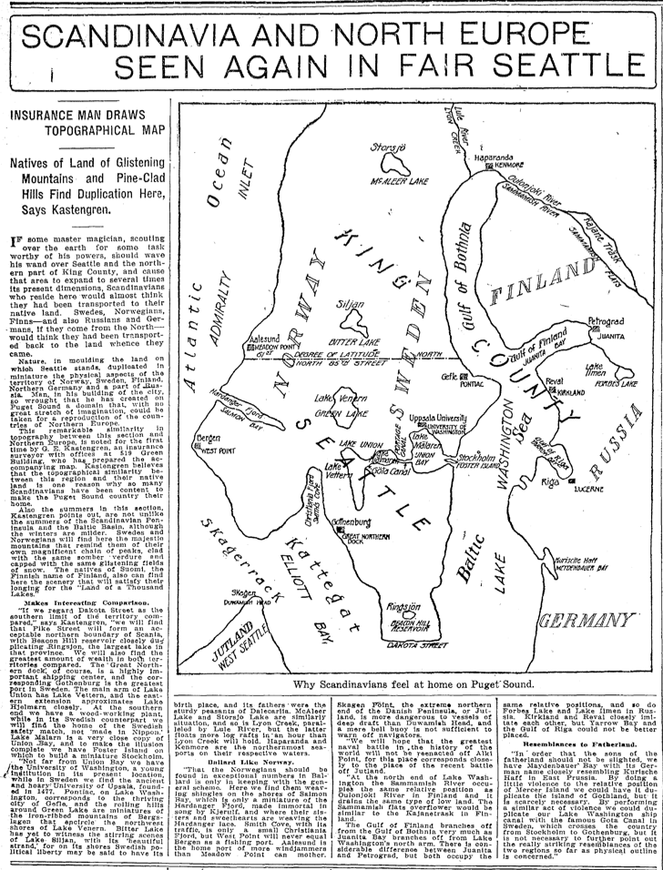
As a researcher, one of my favorites sites to peruse is the Seattle Times online archive, where I can keyword search the newspaper for the years 1900 to 1984. (Unfortunately, access to the site is not unlimited. One way is if you have a library card from Seattle Public Library.) Recently, I came across a crazy map, published on page 24, July 30, 1916. The map superimposes a map of northern Europe on Seattle. It was produced by a G. E. Kastengren, a local insurance surveyor. As the article notes, Kastengren believed that it showed why “so many Scandinavians have been content to make the Puget Sound country their own.”
For example, Norway and Sweden align with Ballard and points north and the U-District and points north. The Gulf of Bothnia, which separates Finland from the rest of Scandinavia, fits pretty well with the northern end of Lake Washington. To the south, Elliott Bay stands in for the straits separating Denmark from its northern neighbors. Kastengren even points out how the University of Washington matches Uppsala University and how Sweden’s largest port, Gothenberg corresponds with downtown Seattle’s big port facility for the Northern Pacific RR. You can also see how the old city boundary of 85th Street runs along what would be the north 61st degree of latitude.
I don’t think the map was ever published any place other than the Times. Perhaps we can revive it somehow. It certainly provides some fun food for thought about our geography and our early day immigrants.

Material for for this story came out of research I did for my book – Too High and Too Steep: Reshaping Seattle’s Topography.
Today’s Microsoft campus overlaps with E-stonia! (Estonians wrote the code for Skype, etc). Estonia declared independence from Russia in 1918, two years after this map; Reval is the German name for Tallinn, Estonia’s capital city.
Great observation and thanks for the insight on the name origin.
David