Although sandblasted into concrete, the version of this map that interests me has a Brigadoon-like nature, or at least it is not always visible. The map shows what is known as the Puget Sound Guide Meridian and is the first map to include Seattle in the great General Land Office (GLO) survey of the United States, or the system of townships that delineated public land into parcels that people could acquire. It is also called the rectangular, or rectilinear, survey system.
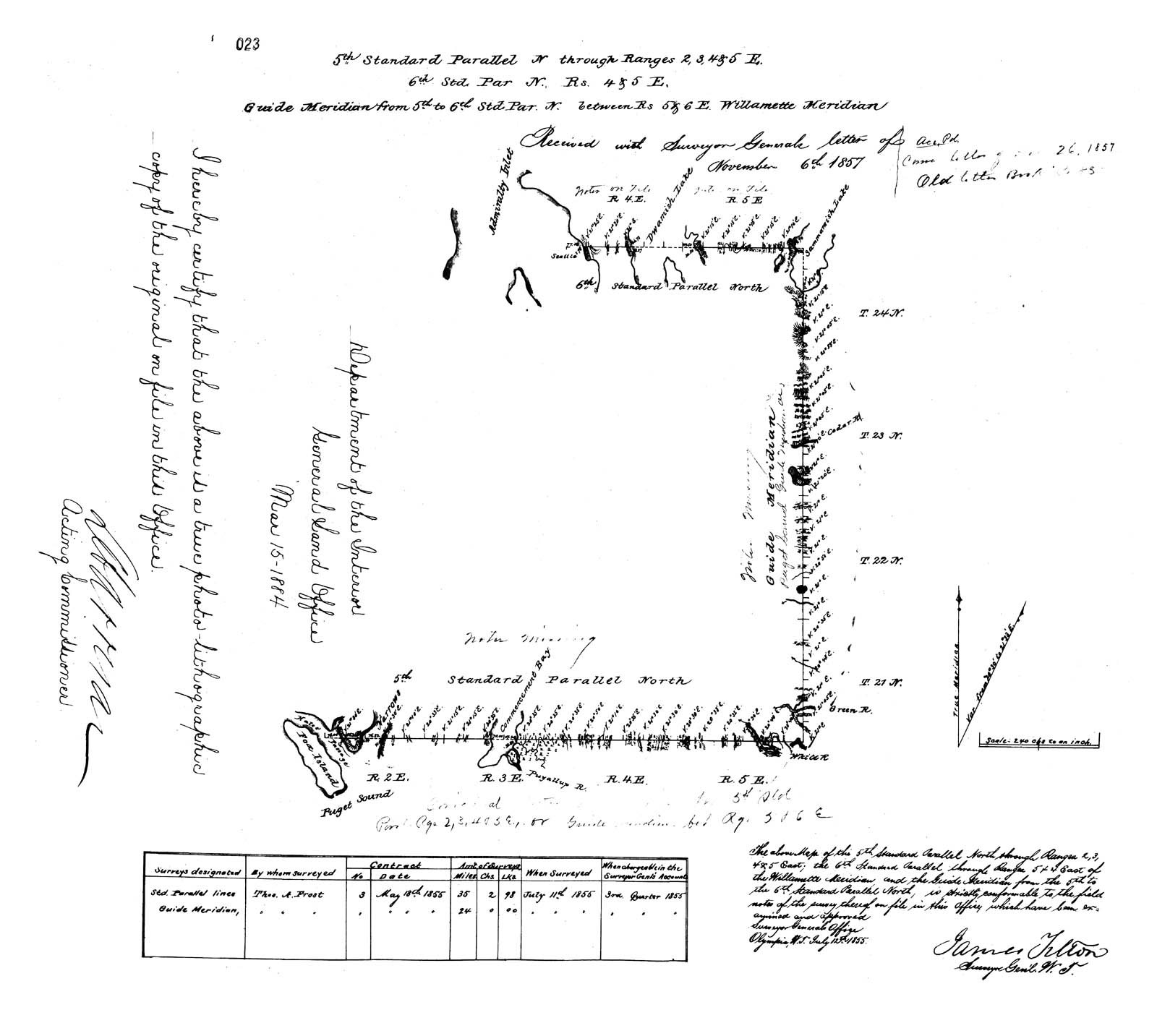 The survey had been established on May 20, 1785, when the United States Congress passed the Land Ordinance of 1785, which would create townships that measured six miles square. Each township was organized around a baseline of meridian lines that ran north south and standard parallels that ran east west.
GLO survey work in Washington Territory began in 1855, two years after the territory had been separated from Oregon. Surveyor Thomas A. Frost was hired to survey three baselines critical for all future surveys of the territory: the Fifth and Sixth Standard Parallels and the Puget Sound Meridian.
All survey work in the state is actually based on the Willamette Meridian, which was established in near Portland, Oregon. You can go to see the spot at the Willamette Stone. Unfortunately, the Willamette Meridian runs through Puget Sound, making it bit challenging to use in this region, which resulted in the establishment of a Puget Sound Guide Meridian. The best detail on this story is Denny DeMeyer’s article, available here as a PDF.
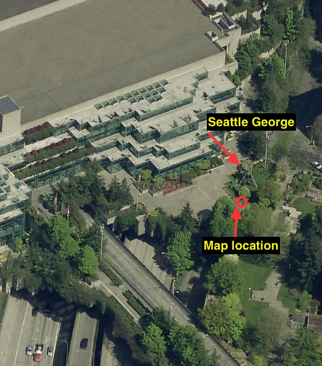
But back to sandblasted map. You can find it in Seattle, or at least try to, near the Convention Center. It’s behind the main Convention Center building in Freeway Park, below the Seattle George Monument by Buster Simpson. Created in 1998, Simpson’s art piece consists of a giant profile made of metal blades, part of which shows George Washington and part Chief Sealth. Just to the south and slightly west of the monument, Simpson sandblasted the map into the concrete, at the southeast corner of plaza. The map is just to the right, or east, of a red kiosk.
As you can perhaps see from the photos, the map is very faint, and on many days is barely visible at all, but it is almost the complete map, including the signature of James Tilton, the surveyor general for Washington Territory. Good luck.
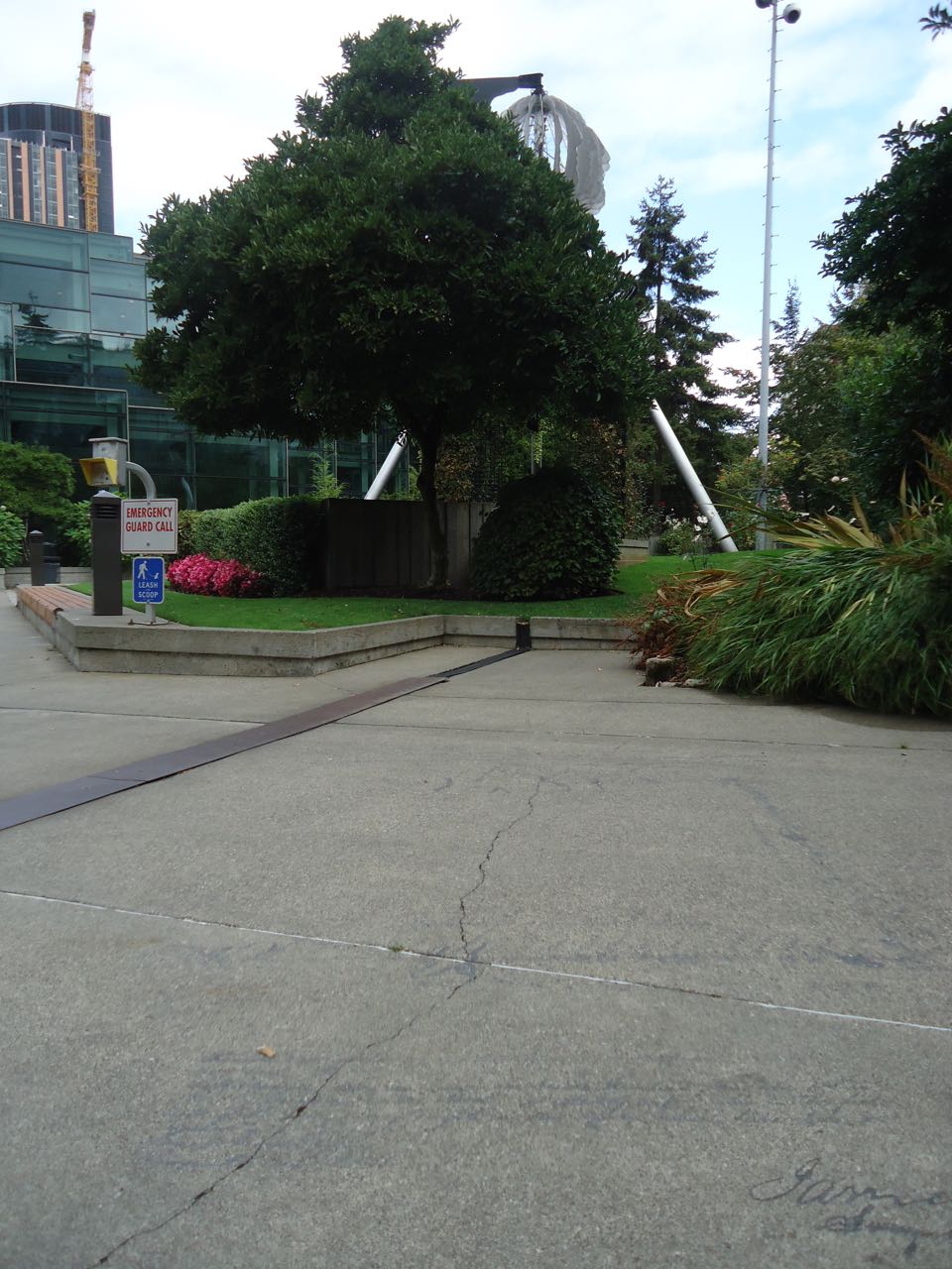
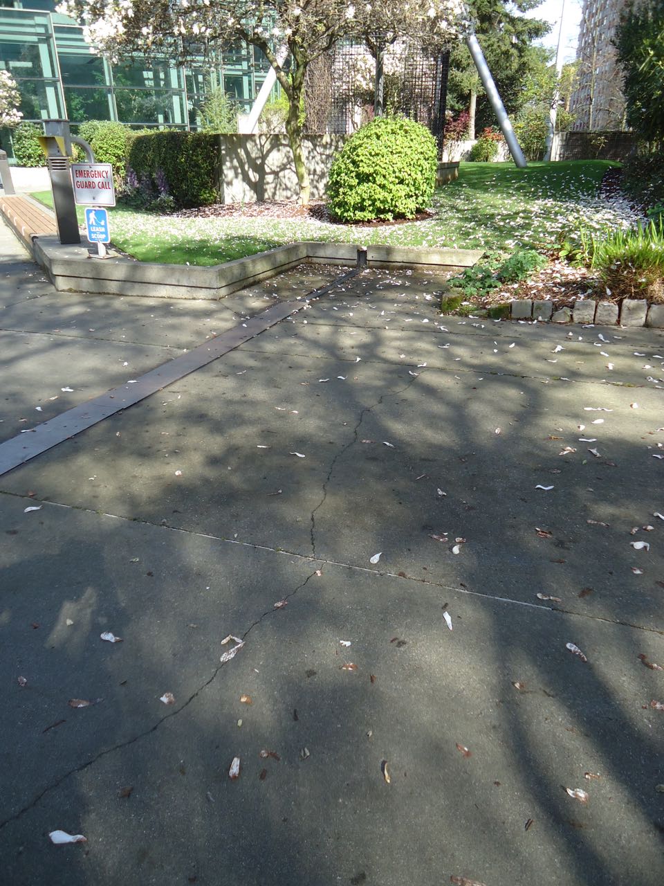
Best to see it when the sun is shining.
Thanks. I also wonder if rain might be okay, as it might highlight the map?