The other day I spent eight hours at Discovery Park watching the tide go out and return. It was the best experience I have had of the dramatic change that occurs in Puget Sound on a daily basis as the level of the water changes as much as 15 feet in a day. Doing this also prompted me to take a look at three maps I have that show the Magnolia peninsula.
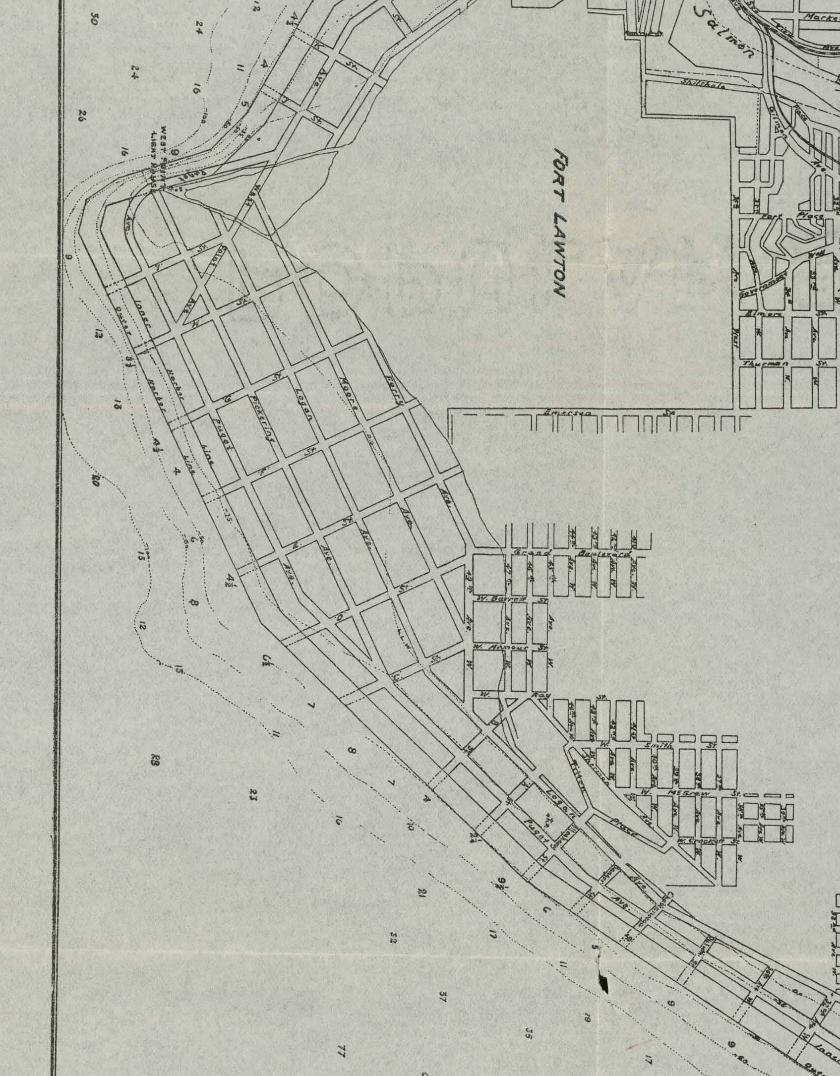
What stands out is that each of the maps shows the low tide terrace platted with streets. It is yet another case of “what the hell were the planners thinking?” I guess they imagined building some sort of wall that would keep the tide out.
It’s also interesting to note the original platted street names changed from 1894 to 1913, followed by another small change from 1913 to 1934. I also like how in the 1913 map, West Point Avenue is planned to cut right across West Point.
Board of State Land Commissioners Map of Seattle Harbor, Surveyed Oct, Nov, Dec. 1893 and Jan. 1894 (click on each map to open a larger version)

Port of Seattle General Map of Seattle Harbor, May 1913
Defense Map, Location of Districts, mapped onto Map of Seattle Prepared by City Engineer’s Department, April 1934

I’ve seen this as well on old maps of Seattle. It’s possible that they planned to build a sea wall so that the tidal flats could be developed. This was actually done down here in the Bay Area at the old Hamilton AFB by Novato, CA. After closure, the sea wall was breached, and the area was once again returned to its natural state. However, I don’t think this is likely the case for Magnolia.
MUCH more likely is that there were plans to fill in this area for future development. This has actually been done in many other places in Seattle, as well as down here in the Bay Area. But for whatever reason, it looks like these plans were scrapped. Unfortunately, there seems to be no information available regarding any plans to develop this area.
Matt, I think you are right, that they had hopes of building a seawall but like many early Seattle plans, it was primarily an idea and not really practical.