Here’s Part 3, and final part, of my posts about Seattle Streams.
Here’s a link to Part 2.
Here’s a link to Part 1.
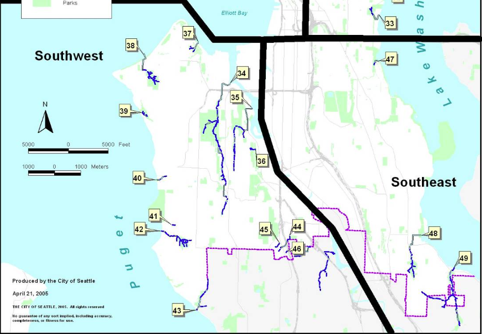
Southwest Streams
34. Longfellow – Flows into Elliott Bay from West Seattle – John E. Longfellow homesteaded near the creek in the 1870s. He logged and farmed his property. The name Longfellow appeared on the 1894 McKee’s Correct Road Map of Seattle and Vicinity, making it perhaps the earliest official name for any creek in the city. It also is designated on the 1897 USGS Topo Map Seattle Sheet. But also see Thornton Creek, which is listed on an 1889 map but does not appear on these other maps, which were more widely distributed.
35. Puget – Flows off east side of West Seattle into Duwamish River – Named for park, which was donated to the city by Puget Mill Co in 1912.
37. Fairmount – Flows into Elliott Bay from northeast side of West Seattle – In 1907, J. W. Clise and S. F. Rathbun (Washington Trust Co.) filed a plat for Fairmount. According to old timers, the West Seattle Land and Improvement Company dammed the creek and pumped the water up the hill to supply water to the residents. A later article, however, noted that the drinking water came from Ferry Gulch, the next ravine north of Fairmount. (Sherwood Files, Seattle Parks Department, Seattle Times, July 29, 1934, Seattle Times, February 7, 1960)
38. Schmitz – West Seattle – German immigrant and one time commissioner of Seattle parks Ferdinand Schmitz and his wife, Emma, donated 30 acres to the city in 1908 so that it would be preserved as a park in perpetuity. (Sherwood Files, Seattle Parks Department)
39. Me-Kwa-Mooks – Flows into Puget Sound – Me-kwa-mooks is a rough sounding equivalent of a Lushootseed word (sbaqwabaqs) meaning prairie point or prairie nose. It refers to a vanished habitat that once dominated Alki Point. (Coll Thrush, Native Seattle: Histories from the Crossing-Over Place.)
40. Pelly – Just north of Fauntleroy.- Bernard Pelly came to Seattle in 1883 and worked with J.D. Lowman in many different businesses in Seattle, including real estate. Pelly later became the British Consul in Seattle. (Correspondence with Patrick Trotter, who is working on a detailed map of all the creeks in Seattle.)
• Gatewood – Tributary of Pelly Creek – Carlisle Gatewood was a real estate developer who arrived in Seattle in 1907.
• Eddy – Tributary of Pelly Creek – Unknown origin.
• Lowman – Tributary of Pelly Creek – James D. Lowman came to Seattle to teach in 1887. He later found Lowman and Hanford stationers. The Lowman and Hanford building is downtown in Pioneer Square area. (From Seattle Parks web site for Lowman Beach Park.)
- Fauntleroy – West Seattle – Named for cove, named by Lt. George Davison in 1857, who took soundings. Name honors his friend and mentor Robert Henry Fauntleroy, an engineer for the U.S. Coast Survey and member of the New Harmony utopian community. Davison also named his brig after Fauntleroy, as well as naming Ellinor, Constance, and The Brothers peaks in the Olympics after Fauntleroy’s children. He later married Ellinor. Despite early naming of cove, creek name does not appear on any early maps of Seattle, though it is recognized as a name in city oridinance 20787 from April 1909.
- Seola – South Seattle – The area was originally known as Kakeldy Beach, for the first people to build a house on the beach. Kids called the residents “Cackilty Chickens” so a contest was held in 1910 for a new name. Mel Miller came up with the name Se-ola, Spanish for “to know the wave.” (Sherwood Files, Seattle Parks Department)
- Durham –Tributary of Duwamish River that entered near where State Routes 99 and 509 intersect – Also known as Lost Fork. Might be named for Leonard R. Durham, who lived in the area. The creek name has been in existence since at least 1937 when Mutual Materials applied for a Certificate of Water Rights to appropriate water from the creek.
- Hamm – Flows into Duwamish River – Named for Dietrich Hamm, a German immigrant who arrived in Seattle in 1887. He was a large landowner in the area. In 1909, through his position on the Duwamish Waterway Commission, he advocated for straightening the Duwamish. (Seattle Parks history for Marra-Desimore Park)
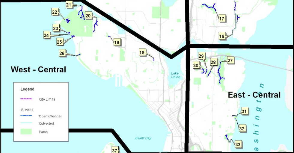
Southeast Streams
- Mount Baker – Assumed to be named for the neighborhood.
- Mapes – Flows through Kubota Gardens in southeast Seattle – Henry P. and Eva Jane Mapes moved to Rainier Beach in 1902 and on October 9, 1909, platted the Mapes Fairview Addition. (Ordinance No. 22207) The Addition is where the modern Safeway sits. Good hints to a wet location come from historic street names in the platted landscape, Marsh Street and Cranberry Street.
- Taylor – Flows into Lake Washington at Rainier Beach – Sanford Taylor established a mill one mile south of Rainier Beach on the shore of Lake Washington. His original mill had been near Leschi but a 1901 landslide that damaged the mill forced him to move south. It employed about 100 people. (University of Washington website photo of Taylor’s Mill at Rainier Beach, Seattle, ca. 1910, from Rainier Valley Historical Society Photography Collection)
Deadhorse – Creek also known as Taylor Creek – Various origin stories. Homesteader Charles J. Walker named it in 1909, after a beloved horse died in the canyon. Or trees felled in the canyon that were hard to move were called “dead horses.” Or a team of horses that were being used to move lumber fell off a road in the canyon. (Rainier Valley Historical Society, Sherwood Files, Seattle Parks Department, Seattle Times, August 19, 2004)
Hitt – Flowed into Wetmore Slough – Thomas Hitt was a fireworks maker in the area, with a fireworks factory on the hill just south of the Columbia City business district. Water from a fairly large spring on what was known as Hitt’s Hill flowed into the creek. (Correspondence with Patrick Trotter, who is working on a detailed map of all the creeks in Seattle.)
Wetmore – Joined with Hitt Creek to flow into Wetmore Slough. – Seymore Wetmore and his family arrived in Washington state in 1853 and helped started Seattle first tannery and shoe factory. They homesteaded in Columbia City in 1870. Early residents in Columbia City referred to the entire creek system, which included Hitt, as both Wetmore and Reservoir creek. (Correspondence with Patrick Trotter, who is working on a detailed map of all the creeks in Seattle.)